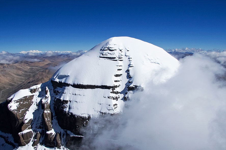
As the Roof of the World, the giant mountains are one of the most attractive factors for tourists who plan to travel to Tibet. It is impossible for normal tourists to ascend to the top of the 10 highest mountains in Tibet, however they can find the best places to admire these mountains with local people's help.
Mount Everest
- Elevation: 8,848.86 m (29,031.69 ft)
- Rank of Altitude: 1st
- Location: Tingri County
- First ascent: British mountaineering party in 1953
The Mount Everest is also known as "Qomolangma", which means "The Mother of Land". The mountain looks like a pyramid standing as high as the sky. 548 continental glaciers are distributed on the giant mountain, and countless ice towers make these glaciers even more shining and beautiful.
Chinese mountaineering party confirmed the exact altitude of the mountain is 8,848.86 meters on the top of Mount Everest on May 27th, 2020. Before that, it was widely believed that the exact altitude was 8844.43 meters. Geologists confirmed that the altitude of the mountain was over 12,000 meters around 13 million years ago.
Most tourists can only admire the Mount Everest at the Everest Base Camp, whose altitude is around 5,100 meters. They usually stay in a local villager’s house for one night to admire the clear sky at night and the sunrise next morning. Tourists, who plan to continue their tour to Mount Kailash, can admire four giant mountains listed as above on the road - Cho Oyu, Lhothse, Makalu, and Shishapangma.
Mount Lhotse
- Elevation: 8,516 m (27,939 ft)
- Rank of Altitude: 4th
- Location: Tingri County
- First ascent: Swiss mountaineering party in 1956
Lhotse means "The Mountain in the South", because it is located three kilometers to the south of Mount Everest. Local Tibetan people also nicknames the mountain "Green Beautiful Fairy Maiden". The east part of the mountain is in Tibet, while the west part stands in Nepal.
Two members of Swiss mountaineering party ascended to the top of the Mount Lhotse along the west slope of the mountain in Nepal on May 18th, 1956. Early March to late May and early September to late October are the best times to visit the mountain.
Mount Makalu
- Elevation: 8,463 m (27,765 ft)
- Rank of Altitude: 5th
- Location: Tingri County
- First ascent: French mountaineering party in 1955
Makalu means "Huge Black Mountain" in Tibetan language. The strong wind blows away the snow on the huge black rocks on the mountain, so it looks a little bit scared. Actually, most parts of the mountain are covered by snow.
Nine members of French mountaineering party ascended to the top of the mountain on May 15th, 1955. And Italian Simone Moro and Kazak Denis Urubko reached the top of the mountain on February 9th, 2009. Generally speaking, late April, early may, September, and October are the best times for ascending the mountain.
Mount Cho Oyu
- Elevation: 8,201 m (26,906 ft)
- Rank of Altitude: 6th
- Location: Tingri County
- First ascent: Austrian mountaineering party in 1954
Cho Oyu means "Great Master" in Tibetan language. It stands in the middle part of the Himalaya range. The world's highest Mount Everest is only 100 kilometers to the east of Cho Oyu.
According to a local story, the Cho Oyu (male) and Everest (female) loved each other, but finally Everest got married with Makalu. Cho Oyu was so sad that he had his head shaved and would never fall in love again. Now, the Cho Oyu looks like a bald Great Master standing lonely beside Mounts Everest and Makalu.
Four members of Austrian mountaineering party ascended to the top of mountain on October 19th, 1954. The late April, early May, September, and October are the best times to ascend the mountain.
Mount Shishapangma
- Elevation: 8,012 m (26,286 ft)
- Rank of Altitude: 14th
- Location: Nyalam County
- First ascent: Japanese mountaineering party in 1964
Shishapangma means "severe cold and variable and bad weather", However, the local Tibetan people consider it as auspicious. It is a risk to ascend the mountain. According to official report 25 people lost their lives while ascending the mountain. April, May, October, and November are the best months to ascend the mountain. Good weather can last two or three successive days during these four months. It is impossible for most tourists to ascend the mountain. They usually admire the mountain on the road to Nepal from the Gyirong Port.
Mount Gyachung Kang
- Elevation: 7,985 m (26,197 ft)
- Rank of Altitude: 15th
- Location: Tingri County
- First ascent: Japanese mountaineering party in 1964
Mount Gyachung Kang is located on the border between Tibet and Nepal. The north part of the mountain is in the Tingri County in Tibet, and the south part is in Nepal. Mount Gyachung Kang neighbors Mount Cho Oyu to the east and is also very close to the Mount Everest. In Tibetan language, Gya means "one hundred", Chung means "valley", and Kang means "snow mountain", so the Mount Gyachung Kang is also known as the Snow Mountain with One Hundred Valleys. There is no highway to the camp of Mount Gyachung Kang. Climbers need to drive to the Rongbuk Monastery and hike around three days to reach the camp.
Mount Chomo Lonzo
- Elevation: 7,804 m (25,603 ft)
- Rank of Altitude: 24th
- Location: Tingri County
- First ascent: French mountaineering party in 1954
The Mount Chomo Lonzo is the 11th highest mountain in China. It is close to the Mounts Everest and Makalu, so not so many people even know its name. However, among the mountains which are completely located in China, it is the second highest. And the highest one is the Mount Shishapangma.
Mount Namcha Barwa
- Elevation: 7,782 m (25,531 ft)
- Rank of Altitude: 28th
- Location: Mainling and Medog Counties
- First ascent: Chinese and Japanese mountaineering party in 1992
As you may have known, "Namcha Barwa" is a Tibetan phrase, however even local Tibetan people do not know the exact mean of “Namcha Barwa”. There are actually three paraphrases of the phrase – "Thunder burning like fire", "A spear stabs through the sky", and "A stone fallen from the sky". Nobody is sure which one is correct, but it is obvious that local people consider the mountain as a natural wonder.
Chinese mountaineering party tried to ascend the mountain in November 1960, but they finally failed. On September 11th, 1992, China invited Japan to ascend the mountain together. After staying in the mountain for 49 days, they finally reached the top on October 30th.
For most tourists, it is impossible to climb the Namcha Barwa, however, they can admire the mountain at the Sekyim-La Pass, where they can see the most beautiful Namca Barwa. Besides, the nearby Lulang Forests and Lake Basumtso are also worth a visit.
Mount Molamengqing
- Elevation: 7,703 m (25,272 ft)
- Rank of Altitude: 33rd
- Location: Nyalam County
- First ascent: Zelanian mountaineering party in 1981
The Mount Molamengqing looks like a man-made pyramid. It is close to the Mount Shishapangma and only 430 meters lower than Shishapangma, so local Tibetan people composed a romantic story about the two giant mountains.
Shishapangma is a goddess. She and the strong Molamenqing love each other very much, but another unknown mountain wanted to seize Shishapangma from Molamengqing. Finally, Molamenqing defeated his rival in love, and he can stay with the Shishapangma forever.
Mount Nemo Nani
- Elevation: 7,694 m (25,243 ft)
- Rank of Altitude: 34th
- Location: Purang County
- First ascent: Chinese and Japanese mountaineering party in 1985
- Best time for ascent: Between late May and Late June
The Mount Nemo Nani stands close to the Mount Kailash, the world’s most sacred mountain in local Tibetan people’s mind. There are 6 major mountain ridges on the Mount Nemo Nani. The only mountain ridge on the east part of the mountain, where forms a 2,000 meters high cliff, is very steep. While the west part is relatively flat. Five huge glaciers are hanging on the five mountain ridges on the west part.
Mountaineering parties from all over the world had been trying to ascend the mountain since 1905, however, their efforts were unsuccessful until 13 mountaineers from China and Japan ascended to the top from the northwest slope of the mountain.


 Data in submission...