Hiking lines of the Everest Base Camp are paradise for hikers. Whether it is the classic hiking line of the Old Tingri County to the Everest Base Camp, the scenic Eastern Everest Base Camp hiking line or the hiking line of the Everest Base Camp to the high altitude, all of these lines make both of the hikers and outdoor enthusiasts itch to try. Today we will analyze in detail what kind of tourists are suitable for these three hiking routes.
Best Time for Hiking in the Everest Base Camp
Hiking in the Everest Base Camp is a challenging travel experience. In order to get the most beautiful scenery, and the most unsophisticated local conditions and customs in the process of hiking, it is really important to choose the departure time. It is not so difficult to hike in the Everest Base Camp in Tibet, especially the hiking route from Tingri to the Rongbuk Temple. This route is full of Tibetan villages and primitive Tibetan sights. However, the weather and the climate are important factors that affect the difficulty of hiking and influence the scenery along the way.
The rainy season in Tibet is from the end of June to the end of August. There are more rains and clouds in the rainy season in Tibet. Therefore, both April-June and September-October are the best time to hike in the Everest Base Camp in Tibet. During these two periods, the weather in Tibet is better and the rain is less. The influence of cloud and fog on the scenery is also the least. Moreover, the natural sights in the spring and autumn seasons are more colorful. While the scenery along the way will be more beautiful and the journey will be more comfortable.
Tip: Be sure to prepare your documents for hiking in the Everest Base Camp before you depart, otherwise you may not be able to complete the hiking of the Mount Everest.
Hiking Line from Old Tingri County to the Everest Base Camp
Old Tingri County is designated as the Gunja Town, Tingri County. Hiking to the Mount Everest from here is the classic line of hiking in the Everest Base Camp.
Scenic Spots Along the Hiking from Old Tingri County to the Everest Base Camp
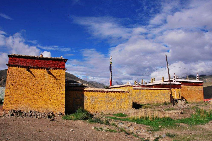
From the Old Tingri County to the Everest Base Camp, the 70 kilometers long hiking will follow the 218 Township Road and pass through several snow-capped mountains. And there are many small local villages on both sides of the road. You can choose this hiking line if you want to know the original Tibetans’ life or experience the daily life of Tibetans.
People who are suitable to hike from Tingri to the Everest Base Camp
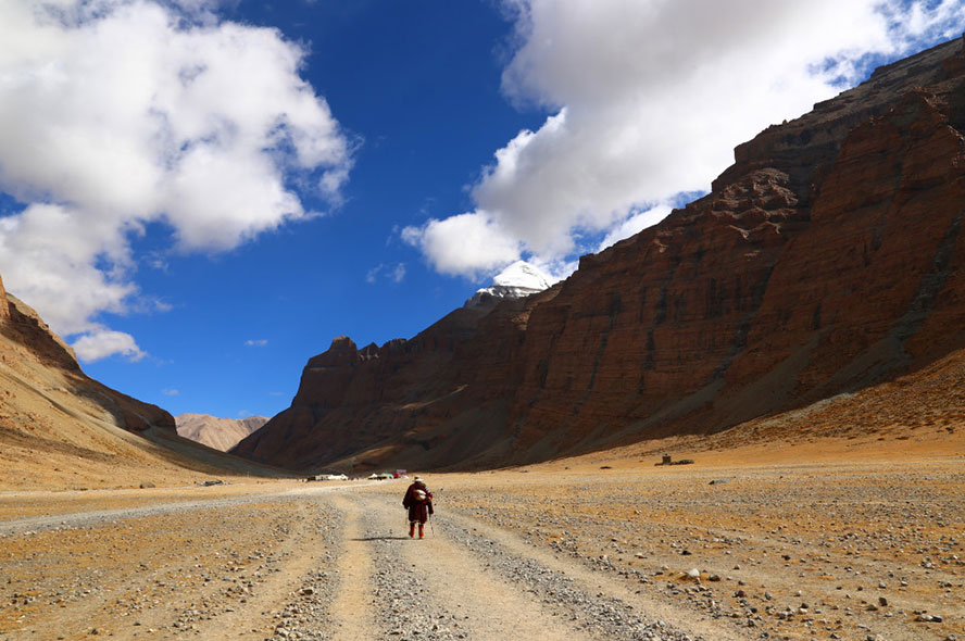
The hiking from the Old Tingri County to the Everest Base Camp is suitable for all people that have no severe altitude sickness, because the rural roads here are flat and open relatively while the journey is safe. Our tour guides are all local guides in Tibet who are really friendly and nice. They will help you to communicate with local Tibetans commendably. The transportation there is very convenient. So if you feel it’s difficult to hike during the journey, you can contact the vehicles at any time to evacuate.
Scheduling of the Hiking from the Old Tingri County to the Everest Base Camp
The entire line from the Old Tingri County to Everest Base Camp is 70 kilometers. In order to have a comfortable journey and leave visitors more time to experience the customs of Tibet, we arranged a four-day itinerary to reach the Everest Base Camp with an average daily journey of about 18 kilometers.
D1: From Gunja Town to Lunjum Village, the journey is 13 kilometers and it takes about 5 hours. Accommodation will be arranged in the Lunjum Village.
D2: From Lunjum Village to Longrua Mountain Pass, the journey is about 21 kilometers and it takes about 8 hours. Accommodation will be arranged in the Longrua Mountain Pass.
D3: From Longrua Mountain Pass to Zangpu Village, the journey is about 18 kilometers and it takes about 7 hours. Accommodation will be arranged in the Zangpu Village.
D4: From Zangpu Village to the Rongbuk Monastery Base Camp, the journey is about 22 kilometers and it takes about 8 hours. The journey from the Rongbuk Monastery to the base camp area is about 3 kilometers and it takes an hour.
Required Equipment for Hiking from the Old Tingri County to the Everest Base Camp
Since the route is flat, it’s OK to prepare the ordinary hiking equipment. Among them, hiking shoes are the most important, and you can equip other dresses according to your own needs. Even the underage children can also walk through this line.
Hiking Line of the Eastern Everest Base Camp and the Gama Valley
The starting point of the hiking is located in Qutang Township, Old Tingri County. The road to Qutang Township is on the left of the crossroad to the Karta County.
Scenic Spots Along the Hiking in the Eastern Everest Base Camp and the Gama Valley
The Gama Valley is located between the Old Tingri County and the Dinggye County, Shigatse region of Tibet. It starts from Chinatown in the east and ends Eastern Everest in the west. It is a beautiful valley at 2000-5000 meters above sea level. The entire valley is untraversed. And here the valley develops the best preserved and the largest primeval forest in the Mount Everest region. This place has long been isolated from the world which keeps the Gama Valley away from the hustle and bustle of the city. There is no outside intrusion. The only means of transportation here is the yak. Many explorers have been impressed by the fantastic beauty of this place, they praise the Gama Valley as the most beautiful valley in the world.
The hiking route on the east slope of the Mount Everest is extremely complicated. The altitude difference here is very large while the road conditions are complex and varied. The whole process takes a long time for 8 days at least. So the hiking route of the Eastern Everest Base Camp is suitable for experienced hiking climbers. Please do not try this route if you do not have any high altitude hiking experience or long hiking experience.
Mileage and Scheduling of the Hiking in the Eastern Everest Base Camp and the Gama Valley
The east slope of the Mount Everest is a famous high altitude hiking route in China. Although the climate varies along the way and the road is difficult for hiking, but the scenery here is extremely percussive. Along the way, you can see the world's first peak Mount Everest (8844.43 meters), the world's fourth peak Lhotse (8516 meters), the world's fifth peak Makalu (8485 meters), and the beautiful Mount Chomo Lonzo. Here is where known as the kingdom of the snow mountains.
- D1: Rapu (3900 meters)--Dumpu-- Shao-Co(4650 meters above sea level) (4 hours on foot)
- D2: Shao-Co (4650 meters)--Shao-Rua(4900 meters)--Xueruo River Valley-- Joksam(4000 meters)(7-8 hours on foot)
- D3: Joksam(4000 meters) --Colong(4320 meters) --Sharlung PastureTangsum(4400 meters) -- Pethang(4550 meters)(6-7 hours on foot)
- D4: Tangsum(4550 meters) --Pethang(4315 meters) --Wuga(4690 meters)(6-7 hours on foot)
- D5: Wuga(4690 meters) --Pethang Ringmo(5310 meters) --Eastern Everest Base Camp(5310 meters ) --Wuga(4690 meters)(10 hours on foot)
- D6: Wuga(4690 meters) --Pethang(4315 meters) --Tangsum(4550 meters)(5 hours on foot)
- D7: Tangsum(4550 meters) --Tsoshutrima(5020 meters)(5 hours on foot)
- D8: Tsoshutrima(5020 meters) --Longma-Rua(5400 meters) --Laze-Co(5050 meters) --Lhundrubling(3990 meters)(8 hours on foot)
Required Equipment for the Hiking in the Eastern Everest Base Camp and the Gama Valley
For the entire hiking route of the east slope of Everest Base Camp, there are no Tibetan settlements but mountaineering camps mostly. So camping equipment need to be prepared throughout the journey. In addition, it is also necessary to equip the waterproof jacket with high performance and high-top hiking shoes, as well as sun protection equipment such as snow cover and sunglasses.
It is also worth noting that the terrain of the Eastern Everest Base Camp is complex and variable. Therefore, local guides must be in place to safely find the right route. Workers and Yaks here will help you to reduce the burden of hiking. Choosing our hiking tour of the Mount Everest, you only need to prepare a healthy body and the hiking equipment that suits you. And then you can start the thrilling hiking tour of the Everest Mountain.
Hiking Line from the Everest Base Camp Area to the Advanced Base Camp
From the Everest Base Camp to the Advanced Base Camp, the airline distance is 15 kilometers and the travel distance is about 28 kilometers. It is the best route to watch the Rongbuk Glacier which is the most beautiful one in China. There are two Intermediate Camps in the whole process. C1 is set at 5500 meters in the Eastern Rongbuk Glacier and C2 is set at 6100 meters in the branch of the peak Changtse. The advantage of this route is that the physical exhaustion per day is relatively small, which is beneficial for the climbers adopt to the environment.
Scenic Spots Along the Hiking in the Everest Base Camp at High Altitude
The Rongbuk Glacier is the greatest attraction for hiking from the Everest Base Camp to the Advanced Base Camp. The Rongbuk Glacier was ranked as the first of the six most beautiful glaciers in China by Chinese National Geographic. The greatest features of the Rongbuk Glacier are the undulating snow-covered peaks, white and holy, sharp and beautiful, that make people feel amazing. The Rongbuk Glacier is in azure blue. The snow mountains in the distance have been dyed green by the spring and the vitality is vigorous, but the low temperature will keep the ice and snow from melting completely.
Appropriate Crowd of the Hiking in the Everest Base Camp at High Altitude
People who have good physical strength, have no severe altitude sickness and have experience in hiking can choose this hiking line.
Mileage and Scheduling of the Hiking in the Everest Base Camp at High Altitude
The distance from the Everest Base Camp to the Advanced Base Camp is about 28 kilometers. Although the road is not so long, but the altitude here rises from 5200 meters to 6400 meters. So the daily travel distance is limited.
D1: From the Everest Base Camp (5200 meters) to the Eastern Rongbuk Glacier C1 camp of 5500 meters above sea level, the route is 5 kilometers and it takes about 5-7 hours.
D2: From the C1 camp to the Intermediate Camp of 5800 meters above sea level, the route is 6 kilometers and it takes about 6-7 hours.
D3: From the Intermediate Camp to the C2 camp of 6100 meters above sea level, the route is 5 kilometers and it takes about 6 hours. You can enjoy the Rongbuk Glacier along the way.
D4: From the C2 camp to the Advanced Base Camp of 6400 meters above sea level and then return to the C2 camp.
D5: Return to the Everest Base Camp area from the C2 camp.
Required Equipment for Hiking in the Everest Base Camp at High Altitude
You will walk on the gravel slope formed by the glacial stones for the whole route from the Everest Base Camp to the Advanced Base Camp. Most of the roads are relatively flat. There are several steep slopes with a fall head of several tens of meters but no drastic ups and downs. On the way, there will be some little glacial meltwater before you reaching 5800 meters. The glacial meltwater will grow larger over time during the spring and summer when are the climbing seasons. After 5800 meters you can see the beautiful forest of icy towers. It’s not necessary to prepare some technical equipment like alpine ski-boots, crampons or ice axes during the entire route.
Note: The ice tower forest along the way is very beautiful, but you may disrupt the rhythm and affect the state easily if you shoot photos while moving. You can choose to shoot more when you go down.
If it’s too difficult for you to choose the hiking lines to the Everest Base Camp, you can also choose other classic lines.


 Data in submission...